At the GeoVirtual Lab at West Virginia University, our research focus was to create interactive augmented reality environments that could be used in a mobile situation. Since the department had a strong connection with emergency services, we focused specifically on real-time emergency services management.
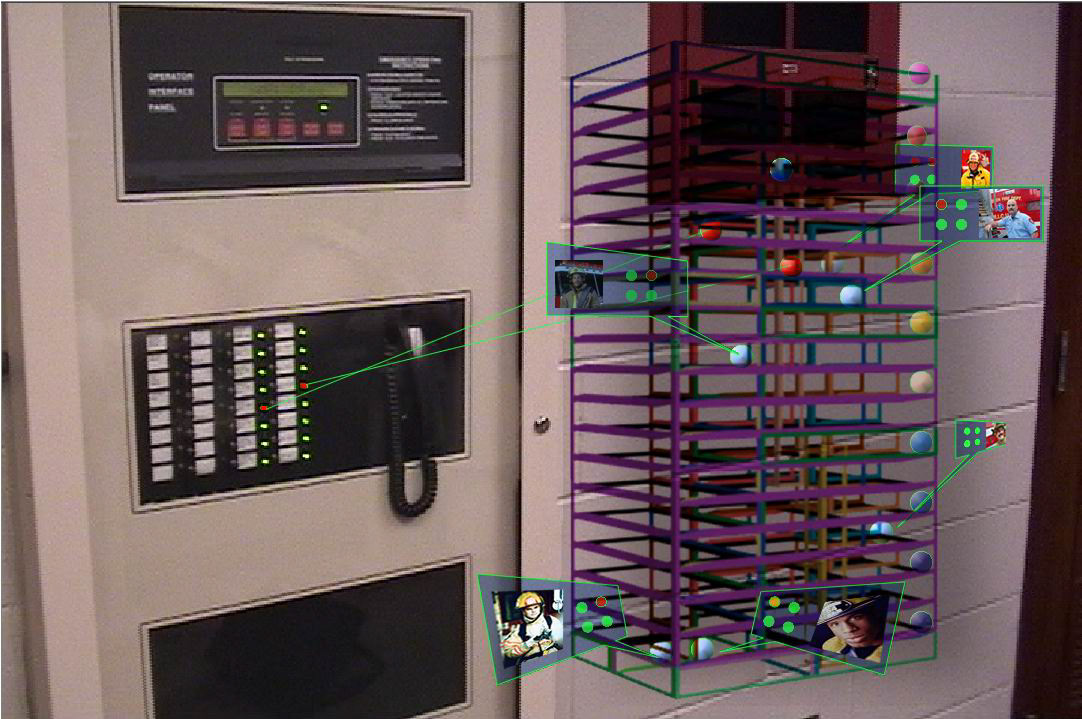
Initial concept was to create a much richer view of the environmental landscape and the location of all human and other assets as they move through a building. By pulling up USGS, GIS and other architectural assets, a real-time model of the environment could be used to locate and direct service personnel through the building with much greater situation awareness.
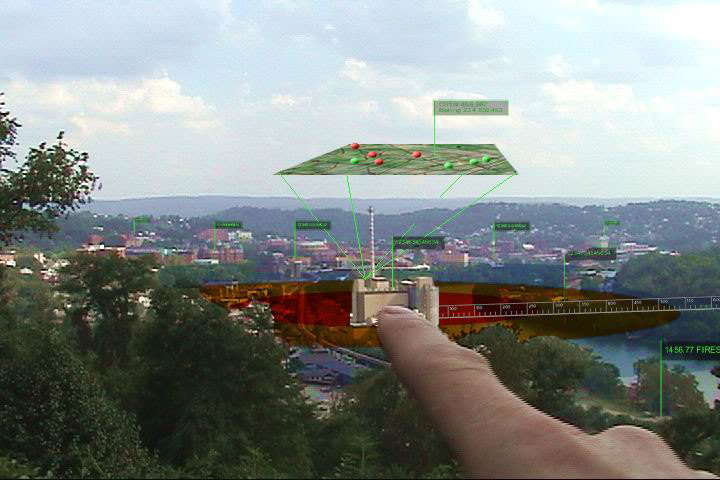
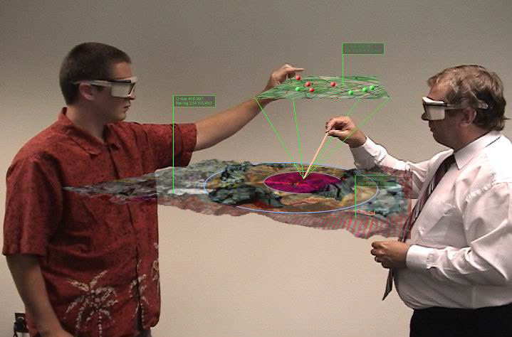
Concept of a mobile, large terrain augmented reality system. By using camera/gesture recognition, the system would overlay interactive data aligned with fixed physical artifacts.